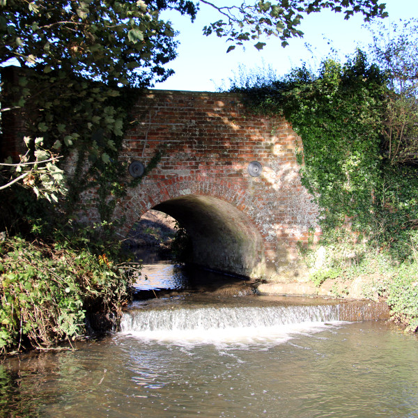
King's Beck Backstory

Home » VILLAGE HISTORY » King’s Beck Backstory

King's beck bridge

Origins of the beck
The stream flowing along the eastern edge of Tuttington is familiar to most local residents, and, especially the dog walkers who cross the humped back bridge on Beck Lane and hear the sound of water flowing over the shallow weir nearby. According to our local historian, Syd Kettle, a mill might once have stood near to where the bridge is now, using the drop in river level to capture energy for grinding corn. Our beck has probably been an important feature of the area for many hundreds of years for power, as a water source, and as a drain.

Most folk know this waterway as King’s Beck. But, others call it Blackwater Beck. What are the origins of the beck and its confusion of names, and is there a regal connection?

To understand any natural waterway, the first origin to identify is the source. Maps show that the beck flows largely from north to south – with several inflowing tributaries – finally emptying into the river Bure at a remote spot called Lady’s Bower between Oxnead and Buxton. On detailed maps many additional minor watercourses can be seen associated with the beck. This is because the natural course of the stream has been much altered over time with addition of many drainage channels.

Referring to the numbers shown on the main map…

1. The source

Tracing the route of the beck on a map as far upstream as possible locates its source near a pond northwest of Roughton. The pond (at the centre of this map) lies in a garden – originally a farmyard – between Felbrigg Road and Back Lane near to the junction with Chapel Road and Metton Road. The source itself might be a spring a little to the north of this site. Beyond, rises the Cromer Ridge which collects the water subsequently emerging at the source.

Downstream, closer to Roughton is a fishing pond most likely produced by damming the beck. A strange fact about Roughton is that it was visited by Albert Einstein in 1933 as he was fleeing Nazi Germany. He liked to sail but there is no mention whether he fished in Roughton.

2. Hagon Beck

Maps name the upper reaches of our stream Hagon Beck which has its own Wikipedia entry. Hagon Beck flows almost unnoticed through Roughton, under the A140 next to the garage and on in a south-easterly direction towards Gunton where power is still taken from the water.

3. Two water mills of Gunton

There was once an old corn water mill with a mill pond on Hagon Beck, mentioned in Domesday Book, within what is now Gunton Park. There is a loop in the beck which diverts some water towards the old mill pond and the other branch flows to the west.

The southwest corner of Gunton Park was decoratively landscaped in the middle of the 18th century producing the Great Water fed by Hagon Beck. This is connected to the lower lake, the (saw) mill pond, by a canal. Both lakes were produced by damming the water flow. The old corn mill associated with the lower lake was eventually replaced by a wood saw mill which is still in working order. The loop branch from the saw mill rejoins Hagon Beck just to the south of Gunton Park.

4. Blackbushe Beck

Further beyond the southern re-joining point of the Gunton loop, drains from the eastern part of Gunton Park merge in Pond’s Head Plantation and empty into the Beck close to Suffield Corner. A large lake was recently landscaped in Pond’s Head Plantation by construction of a dam on the fused drains close to the road near Suffied Corner.

Downstream of this confluence, it is no longer Hagon Beck but the stream becomes Blackbushe Beck. It flows almost due south through Colby. The straightness of Blackbushe Beck along this reach together with the adjacent water meadow drains shows how much the flow of water has been altered by human intervention.

5. Felmingham watermill

Felmingham watermill near the school at Colby Corner lies at the junction of two becks. Blackbushe Beck from the north meets Suffield Beck from the east at the mill pool which has changed over the years. The mill was originally used to grind corn but the millstones were later changed for grinding animal feed and fertilizer.

The mill straddles the beck emerging to the south of the mill pond. The mill race took its power from this stream called Blackwater Beck.

6. Blackwater Beck and Tuttington

The map above is dated 1886 and shows where Beck Lane crosses the beck next to Lower Farm. It clearly shows that it is Blackwater Beck flowing through Tuttington and not King’s Beck. Some modern maps show King’s Beck at this location but others still use the original name of Blackwater Beck.

Further along Beck lane, a junction is reached with a road to the left leading to Hylton’s Crossways. This junction is called Blackwater Corner and it was at one time a crossroads.

7a. The old river crossing

In earlier times, there was a road heading south from Blackwater Corner. It is now a farm track that passes along side the beck for a short distance and then crosses it. The crossing point was originally a ford. Beyond the crossing, the road comes to an abrupt halt while the beck swings south-east. Just before the beck turns to the south again, a tributary flows in from the north east. This is Skeyton Beck.

7b. Black Water Lane

The old tithe map from the mid 1800s shows that the truncated road crossing Blackwater Beck by ford was then called Black Water Lane. Although the road seems to end at a building, crossing rivers by bridge or ford created an expensive problem to overcome. The provision of a ford suggest that Black Water Lane might have extended further at an earlier time.

7c. Where is Beck Lane?

Faden’s map of Norfolk dated 1797 (above) shows Tuttington with its church and Norwich Road heading south. There seems to be no sign of Beck Lane. But, the ford across Blackwater Beck (on the right of the map) is clearly present and Black Water Lane extends west to join Norwich Road. This suggests that the ford along Black Water Lane was at one time the principal means of crossing the Beck at Tuttington and not the crossing at Beck Lane.

8a. Any sign of King's Beck?

The naming of becks seems to follow a pattern. After the confluence of any two streams, the joined waterway adopts a new name. So a new name should be expected after Blackwater Beck is joined by Skeyton Beck just downstream of Black Water Lane ford. Surely, this must be King’s Beck?

Indeed the map of 1885 shows the stream as King’s Beck flowing beside King’s covert and under King’s Bridge. And then it flows a little further south before joining Stakebridge Beck and the Bure.

8b. Is it a beck - or a back?

So it seems that King’s Beck is a relatively short stretch of waterway beginning over a kilometer downstream of Tuttington and ending at the Bure after a further 1.5 km.

But Bryant’s map of Norfolk dated 1826 (above) seems to tell a different story. King’s Bridge shown on the 1885 map went by a different name on the earlier map. It was called Blackwater Bridge. So where is King’s Beck? A clue lies elsewhere in Bryant’s map. Just to the east of the beck is a geographical feature called King’s Back. A spelling mistake perhaps or a misheard local talking broad Norfolk?

8c. The Back of the King

Is there a local feature which used to be called the King’s Back? Britain of the late 18th and early 19th centuries was ruled by a succession of Georges, some with a famously prodigious profile often lampooned in satirical cartoons of the time. Perhaps this profile was seen by an imaginative local in the gentle hills along New Road, Skeyton.

The photo below was taken close to the place called King’s Back by Bryant. Very back-like!

So maybe King’s Beck never existed at all.

The King's Back, ahem, Beck

End of the beck
Whatever the history of King’s Beck, it exists today as an entity even if it is not quite clear what is its correct name or where it starts and ends.

Names of places change and evolve through use, disuse and error so the correct name is what most people call it.

The complex of narrow becks between Roughton and the Bure – and none could be called a river – has nevertheless had an important place in the history of our district.

If our climate is due to undergo significant change as predicted, who is to say whether the local becks will even exist in the future?

But while they are still here, the becks of our district may pass us by almost unnoticed but we should not forget their continuing importance in the story of our village.

The ‘underground map’ summarises the names and relationships of our local waterways.


Acknowledgement.
Parts of old Ordnance Survey maps, Faden’s Map and Bryant’s Map were reproduced either with permission or under the Creative Commons Attribution (CC-BY) licence. The Archive Centre of the Norfolk Record Office, the National Library of Scotland and ESRI are also acknowledged.