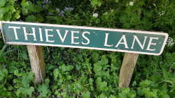
People passing the Thieves’ Lane street sign in Tuttington might have wondered about its origins but probably didn’t notice the spelling error. So what’s the error you might exclaim? Well, it’s just a very small one: an apostrophe after the S.
Closer inspection of the road sign shows the presence of a scratch in the paintwork where the apostrophe should be but this is most likely random damage rather than the work of an irate resident wanting to correct a spelling mistake.
So what difference does the apostrophe make and does it help in working out the origin of this rather strange road name? An obvious first suggestion is that the short road with a dead-end on the west side of the village was once a den of thieves. No reflection on the current residents, of course, who are all wonderful people, no doubt.
For the road to be populated by thieves in former times, the name would not need an apostrophe. The small and much abused punctuation mark converts the word to the possessive form and implies that the road itself or something in or around the track was owned by thieves. The apostrophe after the S says there was more than one thief involved.
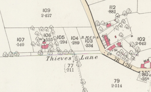
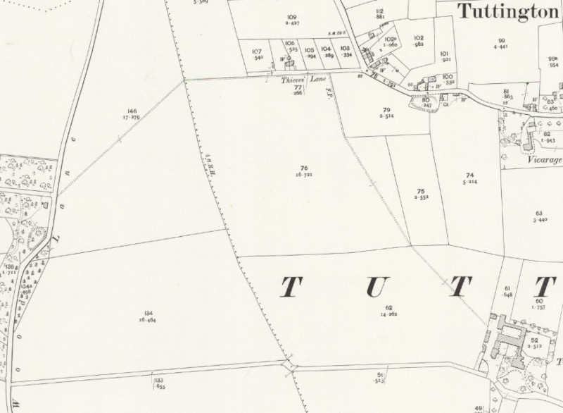
Thieves' Lane Tuttington as shown in the 1886 Ordnance Survey map (National Library of Scotland)
The earliest Ordnance Survey map of the village, dated 1886, lists Thieves’ Lane with its apostrophe, as do modern maps. Strangely, on the old maps of Tuttington, Thieves’ Lane is the only local road named implying some sort of notoriety.
Tuttington’s Thieves’ Lane is not unique in England, nor in Norfolk. There are Thieves’ Lanes in Salhouse, Attleborough and a Thieves’ Bridge Road in Watlington near King’s Lynn. Do these provide any clues to origins? There is a suggestion that the name stems from the activities of smugglers in the late 18th and early 19th centuries. Smuggling was rife at this time when government duties were payable on imported items such as tea, cloth, wine and spirits.
So, could Tuttington residents have been involved in smuggling using Thieves’ Lane to hide their booty from the HM customs prevention officers? Being near to the coast meant that smuggling would have provided a useful – if illegal – source of income in north Norfolk. There was a famous smuggling gang operating out of Northrepps at about this time, reputedly using the hilltop location of Sally Bean’s cottage as a lookout.
But, there was a possible smuggling access route even closer to Tuttington than the coast. The river Bure Canal Navigation was operating by 1778 bringing all manner of goods from across the seas via Yarmouth and finally up to the staithe at Aylsham. At its nearest point, the Bure Canal Navigation was only half a mile from Thieves’ Lane across the fields on the western edge of Tuttington. The quickest route from Thieves’ Lane to the Bure would be across the field to the west and along the track past the barns behind Burgh Hall. It is also possible that the incumbent of Burgh Hall was involved in smuggling but wanted to store the plunder away from his immediate property.
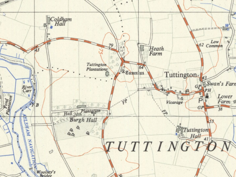
The 1956 Ordnance Survey map of Tuttington showing a footpath (FP) from the end of Thieves' Lane to Wood Lane near Burgh Hall with possible access to the Bure Canal Navigation. (National Library of Scotland)
In support of this idea, several maps show the location of a footpath originating from the western end of Thieves’ Lane heading towards Wood Lane giving nearby access to the track behind Burgh Hall. Although the footpath no longer exists and there are no signs of it on the ground now, it can still be seen as a crop mark in the field in some recent aerial photographs.
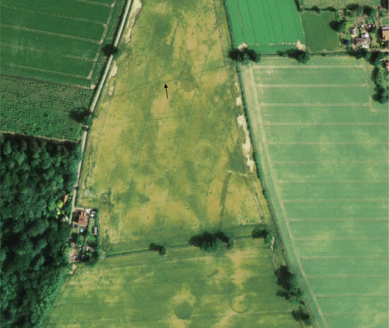
Google Earth aerial image from 2006 showing a crop mark (black arrow) coinciding with the old footpath between Thieves' Lane and Wood Lane. Note also the circular features at the bottom of the image which could indicate the sites of ancient round houses.
There is another possible theory as suggested by the 1906 Ordnance Survey map which shows a continuous path from Tuttington Hall towards Thieves’ Lane then turning west towards Burgh Hall. Perhaps it was this footpath that was called Thieves’ Lane and that the (then) residents of the big house were also involved in smuggling (ed, surely not).
The 1906 Ordnance Survey map showing the continuous footpath from Tuttington Hall to Burgh Hall labeled "Thieves' Lane" (National Library of Scotland)
This is just a speculative and colourful view about the possibly infamous origins of Thieves’ Lane in Tuttington. Current residents of Thieves’ Lane might get some gentle flack about their address or even some amusement but they are probably grateful they don’t live in Ruin Road Worsted, Muck Lane Rackheath, or World’s End Lane in Reepham!
We use cookies to ensure that we give you the best experience on our website. If you continue to use this site we will assume that you are happy with it.